Clarity From Day One So Your Real Estate Projects Never Stall
We deliver precise, validated geospatial intelligence that helps developers, architects, and investors avoid costly mistakes and move projects forward with confidence.

Frustrated with mismatched layouts, unclear boundaries, and mid-project surprises?
Most planning errors happen because the data you rely on isn’t validated.
Our Core Services

Interactive Maps (SIDM™)

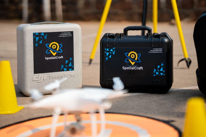
Aerial Mapping

Physical Survey

Why Choose SpatialCraft?
- Solutions That Prevent Costly Mistakes
- Clarity Over Assumptions
- Deep Technical Expertise Backed by Real Experience
- Trusted by Leading Developers, Planners, Governments & Institutions Across Goa.
- Awarded Best Innovation in Drone Technology by #StartupIndia
Client Testimonials
What our clients are saying about us.
"Malcolm and his team are extremely professional. They did the survey on complete priority shared the results in multiple formats with us and our architects also clarified with us on the results on multiple occasion. When we asked for revisions, they provided us the same most importantly, even on a rainy day, when we had just two hours of Sunshine, they make sure that the survey is completed and results are delivered on priority."

Spatialcraft came highly recommended to us, and they exceeded all expectations. Their punctuality isn’t just about arriving on time — it’s about respecting our timelines and our urgency. Every interaction with their team was marked by transparency, clarity, and clear direction. What we valued most was their ability to simplify complicated data and offer practical, tailored solutions. They are advisors who care about their work and outcome to a level which give a client a feeling of complete trust.

"It was a superb experience working with Spatialcraft.... Our land Survey was done in a very professional manner... would definitely share your details to other corporates also... Let's work on our next projects soon... Thanks once again "


Awards and Recognitions
Awards & Recognitions
- Best Innovation in Drone Technology — Startup Ka Mahakumbh (2024).
- Outstanding Innovation in Smart Interactive Digital Maps — World Business Conclave (2024).
- Best Emerging Startup — Lokmat Goa Startup Tourism Awards (2024).
- Innovation Award — JCI Margao.
- Government of Goa Seed Fund Recipient.
Frequently Asked Questions
What services does SpatialCraft offer for real estate projects?
SpatialCraft offers aerial drone mapping, DGPS ground surveys, contour maps, terrain analysis, land zoning analysis, plot boundary verification and demarcation, and interactive WebGIS platforms specifically designed for developers, architects, and land investors. We deliver planning-ready datasets that eliminate ambiguity and give you full clarity of your site before acquisition, design, or development begins.
What experience does SpatialCraft have in the geospatial and real estate industry?
SpatialCraft brings years of expertise in GIS, remote sensing, drone surveying, and DGPS land surveys. Led by a gold-medalist geologist and supported by a skilled technical team, we have successfully delivered solutions for top real estate developers, architects, land investors, village panchayat bodies, smart cities, and government institutions. Our work spans complex terrains, large land banks, plotted development layouts, and litigation-sensitive sites.
How does SpatialCraft ensure accuracy and reliability in its data?
SpatialCraft follows a hybrid workflow that combines high-resolution drone data processing with DGPS ground control validation. This ensures centimetre-level accuracy across all deliverables. Every dataset is double-checked through spatial cross-validation, visual inspection, and automated processing pipelines. This combination of precision and verification allows planners and architects to rely on our data with full confidence.
How can SpatialCraft’s mapping and digital maps improve my project outcomes?
By providing ultra-detailed maps, accurate contours, and visually validated boundary overlays, SpatialCraft helps you design layouts more confidently, avoid misalignments, and plan access, zoning, and utilities with clarity. Investors and developers use our digital maps to evaluate feasibility, speed up decision-making, reduce uncertainty, and give their teams a shared single source of truth.
How do SpatialCraft’s services help reduce cost, delays, and rework?
Most rework in real estate happens because of incorrect or outdated site information. SpatialCraft eliminates these issues by giving you accurate, validated land data from the start. This prevents boundary disputes, redesigns, and layout misalignments while cutting down on multiple site visits. You save time, avoid costly surprises, and move projects forward faster.
What makes SpatialCraft different from traditional surveyors?
Traditional surveys rely heavily on assumptions, temporary reference points, and limited field measurements. SpatialCraft combines drone-based mapping, DGPS ground truthing, and WebGIS visualization to create fully validated, visually rich datasets. This gives you absolute clarity and long-term accuracy that manual surveys cannot match. We deliver solutions, not just raw data.
How quickly can SpatialCraft deliver results?
Turnaround time depends on site size and complexity, but most real estate projects are delivered within 2–5 working days. Our streamlined workflow enables fast data capture, efficient processing, and rapid delivery of CAD files, drone maps, and interactive WebGIS links.
Will SpatialCraft’s data integrate into my architect’s or planner’s workflow?
Yes. All outputs are provided in industry-standard formats such as DWG, DXF, GeoTIFF, KML, and web-based interactive maps. Architects use our data directly inside CAD, while developers and investors rely on WebGIS maps for insights. No new software or technical learning is required.
Does SpatialCraft help with boundary disputes or land due-diligence issues?
SpatialCraft is frequently engaged to validate boundaries, identify encroachments, check alignment with government plans, and document discrepancies. Our evidence-grade data helps clients avoid litigation, negotiate confidently, and settle disputes with clarity and transparency.
How do I get started with SpatialCraft?
Getting started is simple. Share your site location and project expectations with us, and we’ll schedule a discovery call to recommend the exact survey package you need based on your project needs. We then schedule data capture, process the outputs, and deliver planning-ready digital maps. SpatialCraft also provides post-delivery support to ensure your team can use the data effectively.
Ready to Bring Clarity to Your Real Estate Project?
Early validation saves time and money. Lock in your consultation now.
Whether you’re acquiring land, validating boundaries, planning layouts, or preparing investor presentations — we ensure you have complete clarity from day one.
Contact Us
We'd love to hear from you! If you have any questions, feedback, or need assistance, please feel free to reach out to us using the contact details provided. Our team is here to help and will respond as soon as possible. Thank you for getting in touch!
Phone
+919588475585