“Build
a Smarter, Transparent, and Well-Planned Village with Spatialcraft's Geospatial Mapping”


" Spatialcraft helps Panchayats safeguard their lands, plan better infrastructure, and empower citizens with clarity and trust "
Our Solution
Essential tools for the future.
Drone Mapping of Entire Village:
A high-resolution digital fingerprint of your land, roads, homes, and open spaces.
Smart Interactive Digital Map (SIDM™):
One Map, all answers villagers, officials, and planners can access accurate, visual, and interactive data.
Time-Stamped Proof:
Future
disputes or inquiries? The Panchayat will always have clear visual evidence.
Pro-Village Vision
Every Village needs this
Integration with Planning Maps:
Overlay Regional Plan, survey maps, and government datasets directly on the village map.
Decision Support
Helps in preparing Village Development Plans, biodiversity registers, eco-tourism trails, and enforcement reports. Reduce months of survey & inspection delays to just days.
Proven in Goa. Trusted by Governments.
A New Way Forward for Villages:
How It Works

Drone Mapping:
Capture
high-resolution imagery of the entire village

Digital
Access:
Provide
a secure web platform and GIS package for offline use.
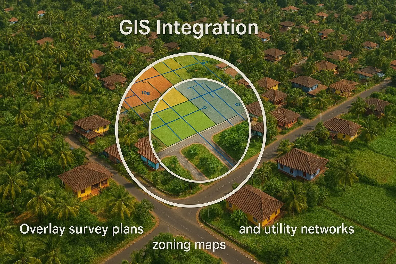
GIS Integration:
Overlay
survey plans, zoning maps, and utility networks.
WHY SPATIALCRAFT
Award-winning geospatial innovation company.
Fast, accurate, consultative delivery in days, not months.
Goa-based, with deep knowledge of local planning issues.
Recognized for transforming real estate, governance, and environmental planning with Smart Maps.
Testimonials from villages, government projects, and real estate clients.

CSR & Community Support
“Goa’s Villages Need More Than Just Maps”
While Panchayats benefit from our mapping and digital platforms, some village challenges need larger-scale support—like encroachment-free roads, eco-tourism trails, and clean water systems. That’s where CSR and community partners come in.
Ready to see the ground truth?
Contact SpatialCraft today to discuss your project:

Phone
+91 95884 75585