
A silent land risk in Goa is going largely unnoticed.
Boundary inaccuracies are quietly compounding across properties and most stakeholders remain unaware.
The Problem with Modern Reference Points
Today, many land demarcations are based on recent visible references, features that emerged decades after the original 1972 survey:
Compound walls constructed over the past 40–50 years
Adjacent buildings and site developments
Informal, undocumented agreements between neighbours
However, none of these were part of the original 1972 survey records, the only legally recognized framework maintained by the Department of Survey and Land Records.
And this is where the issue begins.
Error Propagation
To understand this, consider a simple sequence:
The original boundary is established with precision.
Over time, the first landowner constructs a compound wall, slightly misaligned, perhaps by just 0.5 meters.
When the next survey is conducted, instead of referencing the original survey data, it aligns itself to this newly built wall.
As a result, the next plot inherits a shifted boundary.
Each subsequent demarcation references the last visible boundary, not the original record.
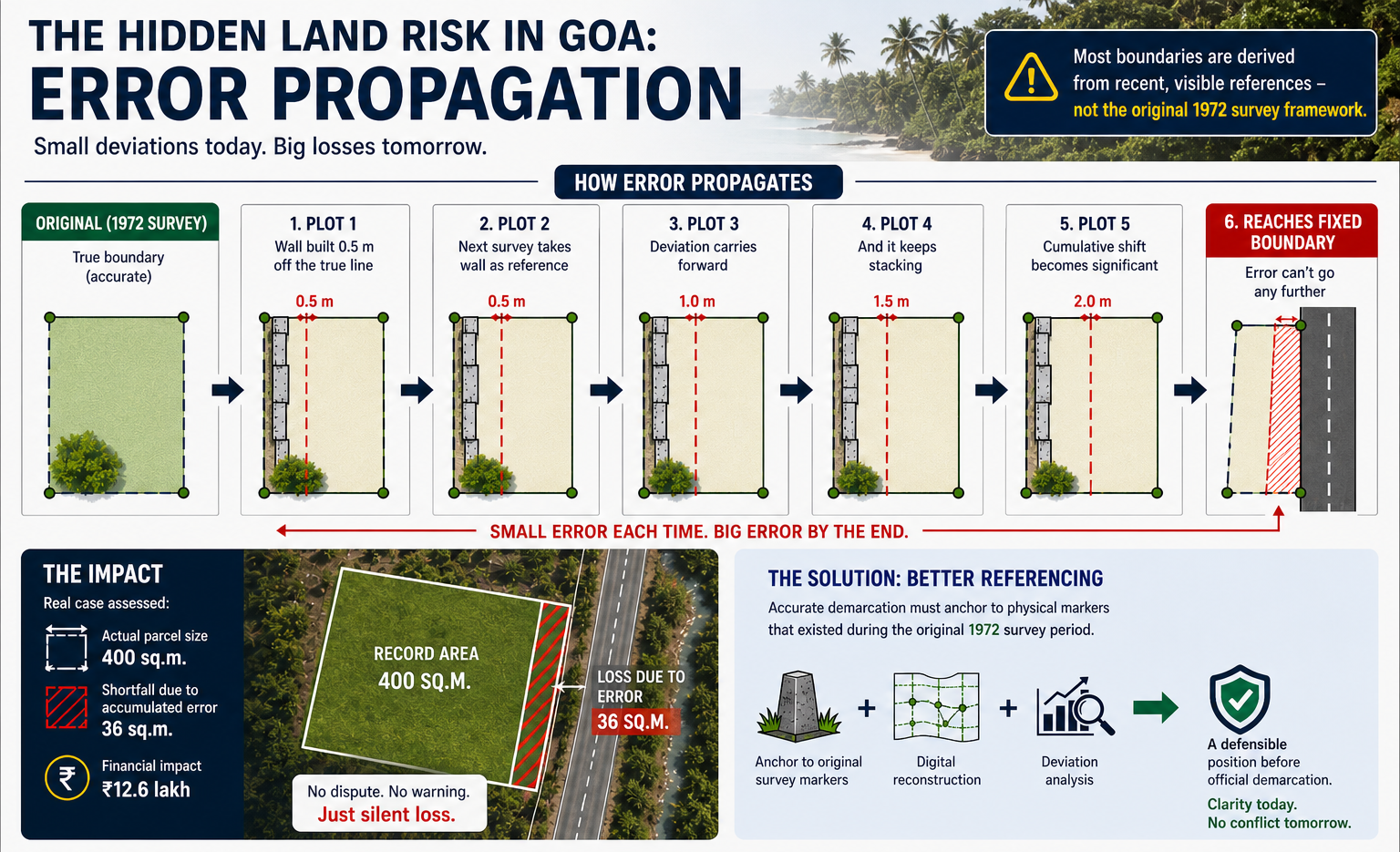
Individually, each deviation is minor.
Almost imperceptible.
But cumulatively, they begin to alter the entire alignment.
By the fifth or sixth property, the boundary line has drifted significantly from its original position.
Yet, everything appears consistent within the local context.
There is no immediate indication of error.
The Problem Escalates at Fixed Constraints
Until the system encounters a fixed constraint:
A road
A nalla
A government boundary
These reference points have not moved.
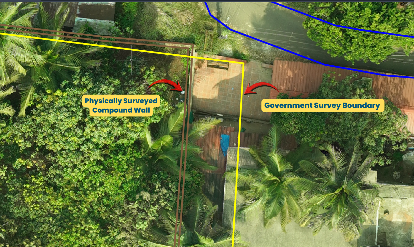
At this stage, the accumulated deviation can no longer be adjusted.
It compresses into the final parcel.
And the last landholder absorbs the entire discrepancy, in the form of reduced land area.
Individually, these errors seem negligible.
Collectively, they reshape entire layouts.A System That Appears Correct, But Isn’t
The result is a system that is:
- Internally consistent
- Widely accepted
- Fundamentally incorrect
Case Assessment
In one assessed case:
400 sq.m. parcel
36 sq.m. shortfall
₹12.6 lakh financial impact
No dispute.
No warning.
Only a measurable loss.
The Real Issue
The issue is not the frequency of surveys, it is the integrity of their reference points.
Accurate demarcation must anchor to physical markers that existed during the original survey period — not contemporary assumptions.

What Accurate Demarcation Requires
When combined with:
- Digital reconstruction
- Deviation analysis
…it becomes possible to establish a position that is both accurate and defensible prior to official demarcation.